


FLORIDA DEPARTMENT OF TRANSPORTATION
Executive Summary
Travel time is an important performance measure used to assess the traffic operational quality of
various types of highway facilities. Previous research funded by the Florida Department of
Transportation (FDOT) on travel time reliability developed, implemented, and evaluated tools
for estimating travel time reliability for freeways and arterials. Previous research efforts have
also compared the model-estimated travel times to field-measured travel times. To perform these
comparisons, various sources of data have been used. Given the variety and diversity of data
collection methods, it is important to evaluate the accuracy of the data obtained by each of them
and to develop recommendations regarding their suitability in the validation of travel time
estimation models as well as in the development of real-time travel time reliability metrics.
The objectives of this research were to: a) identify the locations and times when travel time data
are collected by each method, b) collect field data along the selected freeways and arterials using
an instrumented vehicle, c) statistically compare the field measured travel times with the travel
times collected by various methods.
The available travel time data collection methods evaluated in this study are STEWARD,
INRIX, BlueTOAD, and HERE traffic. STEWARD travel times were available for the majority
of the freeway segments in Florida. INRIX data were available for several freeways and arterials
in Florida; however, these data did not cover the entire data collection period as these were
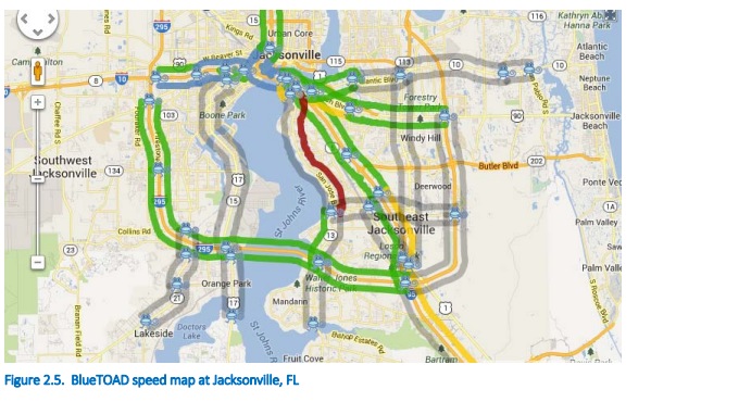
available only for a limited time period (until September 2013). BlueTOAD travel times are only
available in the Jacksonville area (freeways and selected arterials). HERE data cover the majority
of the freeways and specific arterial segments in Florida; however, travel time data prior to
October 2013 are not available.
Travel time data were obtained at five freeway segments (both directions) and two arterial
segments (both directions) under varying traffic conditions. At least five travel time
measurements were obtained at each location. The travel time data were collected using an
instrumented vehicle equipped with a GPS. The data collection recorded speeds as well as video
of the surroundings and prevailing conditions during the data collection.
Two statistical comparison methods were used. The first method constructed a confidence
interval which was specified by a maximum relative error. The second statistical method was
based on a selected acceptable range for the absolute percent error. A statistical analysis by
facility type and by congestion level was also developed.
The results of the statistical comparison suggest that the HERE traffic data provided better
freeway travel time estimates, compared to the remaining methods. HERE traffic is more
accurate for oversaturated conditions. On the other hand, when analyzing uncongested freeway
segments, STEWARD, INRIX and BlueTOAD performed better than HERE traffic. Lastly,
analysis at the arterial sites suggested that none of the methods was accurate, although the
sample size was relatively small, especially during the oversaturated runs.
Download full version (PDF): Measuring Travel Time at Florida Freeways and Arterials
About the Florida Department of Transportation
www.dot.state.fl.us
The Florida Department of Transportation (FDOT or Department) is an executive agency, which means it reports directly to the Governor. FDOT’s primary statutory responsibility is to coordinate the planning and development of a safe, viable, and balanced state transportation system serving all regions of the state, and to assure the compatibility of all components, including multimodal facilities. A multimodal transportation system combines two or more modes of movement of people or goods. Florida’s transportation system includes roadway, air, rail, sea, spaceports, bus transit, and bicycle and pedestrian facilities.
Tags: FDOT, FL, Florida, Florida Department of Transportation
 RSS Feed