


AIRPORT COOPERATIVE RESEARCH PROGRAM
Guidebook on Integrating GIS in Emergency Management at Airports
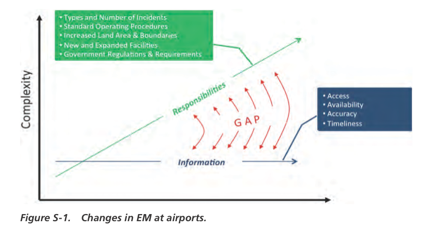
As airspace and aircraft surface management demands increase, emergency management (EM) responsibilities and requirements become more complex and demanding. Information provided to EM operations is not keeping up with the increase in EM operation responsibilities and complexity. If trends hold true, the gap between the need for more information will continue to increase over time, creating a risk to EM operation efficiencies and effectiveness. This phenomenon is shown in Figure S-1. Even when information is available, the accuracy of the information can be questionable.
A geographic information system (GIS) can be a productive tool to enhance EM and significantly reduce the gap in information flow and accuracy. For example, several airports have airport-specific assets mapped in various GIS layers including the following:
- Runways;
- Gates;
- Terminals and buildings;
- Roads and parking;
- Power stations and utility lines;
- Storage facilities;
- Fire suppression and alarm system components;
- IT infrastructure, location of on-site staging areas; and
- Other items, such as lease space/tenant information.
These assets and their associated information can be key components to modern day EM operations.
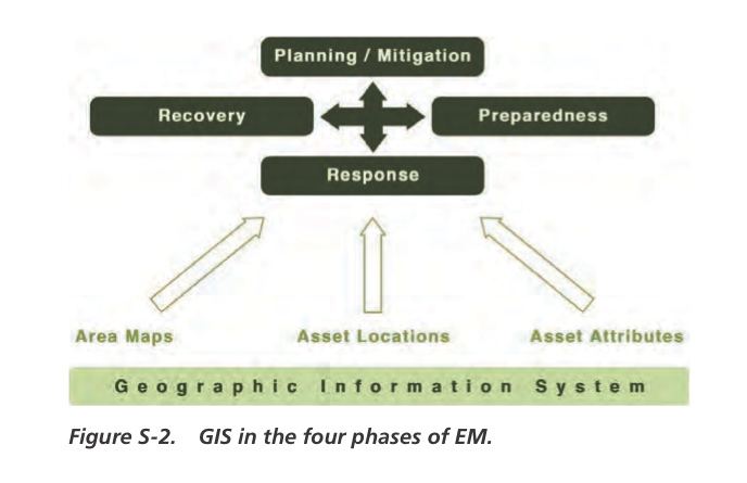
As represented in Figure S-2, improved technologies and information available through GIS can contribute to the benefit of each phase of EM operations. In preparation for possible fire and/or aircraft accidents, for example, a properly developed and designed GIS can be used to generate maps that show these assets. This can assist response units in directional wayfinding and in locating crucial assets necessary to respond to an accident.
There are emerging success stories with integrated GIS today. For example, a major U.S. airport undertook various GIS efforts, which provided substantial benefit for the Operations Department and their EM efforts through a Web-enabled mapping tool designed for desktop users that benefits field operations. Accurate interior building GIS data also enabled the development of emergency evacuation maps for the Operations Department. Such maps provide enhanced public safety as well as improved training information for emergency personnel.
Another example is a major U.S. port authority that developed a GIS application available to all port users that provides quick access of approximately 80 service maps organized by like services such as Properties, Transportation, Utilities, Natural Resources, and Environmental, among others.
Read full report (PDF) here: Integrating GIS in Emergency Management
About The Airport Cooperative Research Program (ACRP)
www.trb.org/ACRP
“The Airport Cooperative Research Program (ACRP) is an industry-driven, applied research program that develops near-term, practical solutions to problems faced by airport operators. ACRP is managed by the Transportation Research Board (TRB) of the National Academies and sponsored by the Federal Aviation Administration (FAA). The research is conducted by contractors who are selected on the basis of competitive proposals.”
Tags: ACRP, Aviation, Integrating GIS in Emergency Management, TRB
 RSS Feed